Most people asking about this corner of Somerset and Devon have one picture in their head, and it is a wide brown moor with nothing on it. That is about a third of what is here. The rest is combes, which are steep wooded valleys cut into the moor's edge, some of them so deep and narrow that the sun reaches the stream for only a few hours in midwinter. You book a week on Exmoor expecting horizon and you spend half of it under oak.
The second thing people are not expecting is the sea. The moor does not tail off into farmland on its north side. It ends. Between Foreland Point and Combe Martin the ground falls from around 1,000 feet straight into the Bristol Channel, and the coast path runs along the top of that drop for miles at a stretch. Great Hangman, the high point of the whole thing, stands 1,043 feet above the water and is the tallest sea cliff in England.
And it is small. From Simonsbath, near the middle, you can reach the north coast in about 30 minutes and the southern edge in about 40. That is the practical case for one base rather than three: you are not moving your luggage to see a different part of the ground, you are driving 20 minutes before breakfast has settled.
- What the week is
- Six nights in one house or inn, with walking from the door on four days and a short drive to a coast path start on the other two.
- What sets it apart
- Exmoor covers about 267 square miles against Northumberland National Park's 405, and the whole of it sits within a 40 minute drive of the coast; the moor's high point, Dunkery Beacon, is 1,705 feet, and the coast path between Lynmouth and Combe Martin climbs about 4,900 feet across 13 miles; the nearest rail station is Tiverton Parkway or Taunton, both about a 45 to 60 minute drive from Porlock, so the transfer is short; and prices sit around $1,990 for six nights against a Northumberland week that runs longer on the road in every direction.
- What the figure covers
- Six nights in one base, either an inn room or a whole cottage; breakfast on all six mornings; a printed set of day routes at 1:25,000 with grid references and the exact stiles and gates; two days with a local walking guide who is employed by a company we book, not by us; airport or station transfer from Tiverton Parkway, Taunton, Exeter or Bristol; a rental car for the six days with the excess reduction already paid; and a written figure for the whole week before anything is confirmed.
- What it leaves to you
- International flights; lunches and dinners on all six days; drinks; the dark sky night at the observatory, which is booked directly with the site and costs about $18 a head; entry to houses, gardens and the two cliff railways; fuel and any parking beyond the base; luggage handling; walking boots, waterproofs and a compass, all of which you bring; anything you add once you are there, such as a pony trekking morning or a boat trip out of Lynmouth; gratuities; and any change of dates once the week is confirmed, which is dealt with under our cancellation terms and may carry a charge from the house or the guiding company.
- Who this one is wrong for
- Anyone who does not want to drive: the base sits on single track lanes with passing places and high hedgebanks, and the last mile to several houses has grass down the middle. Anyone who needs level ground: almost every walk here either drops into a combe or climbs out of one, and the coast path sections gain 900 to 1,400 feet in a morning with loose, stony descents. Anyone set on long dry spells: the high moor takes roughly 70 inches of rain a year and December through February the tops are in cloud for days together.
Ground that goes up and down more than it goes along
The map lies to you here, and it lies in a specific way. Six miles on paper between two villages will often be six miles of crossing three combes, and each crossing costs you 400 to 600 feet down and the same back up. A route that looks like an easy afternoon takes five hours. Our day sheets give ascent in feet for exactly this reason, because distance on its own tells you almost nothing about how the day will go.
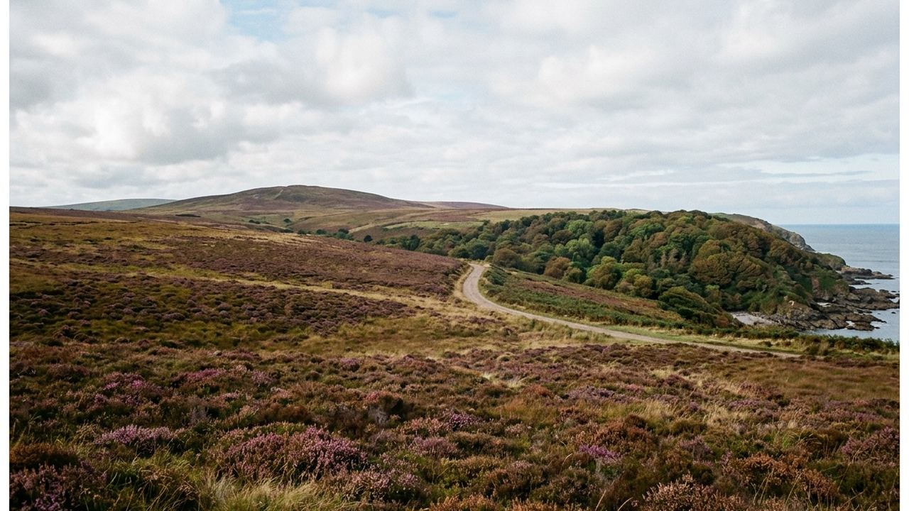
Underfoot it changes fast. The high moor around Dunkery and The Chains is heather, purple moor grass and peat, and after a wet week the peat holds water like a sponge; there are stretches where you sink to the ankle for a quarter mile. Drop into a combe and you are on leaf mold and exposed tree root, often steep enough that people come down sideways. The coast path between Lynton and Hunter's Inn is the firmest walking of the week and also the most exposed, a narrow shelf with a long slope below it and no fence for most of the distance.
Then there is the Valley of Rocks, which behaves like nowhere else on the moor: a dry valley running parallel to the sea with rock towers standing along it and feral goats on the ledges. It is a 40 minute walk from Lynton and it is flat, which after four days here you will notice.
People who came for one thing and found another
We spend a good part of every first conversation working out which of two places somebody actually means. Both have open ground, both have dark skies, both put a person a long way from a streetlight. They differ in ways that matter once you are standing in them.
Twelve months, and what the ground is doing in each
Weather here is a local business. The north coast under the moor is milder than the tops by several degrees, palms grow in Lynmouth, and you can leave a village in shirtsleeves and be in cloud 900 feet later. The single figure worth carrying is the rainfall: about 70 inches a year on the high moor against roughly 30 on the coastal fringe.
- Late March to mid May
- Dry spells more likely than any other stretch, average highs around 54F, bluebells in the combes from late April, and the coast path is quiet
- June to August
- Highs around 68F, longest daylight, and the whole Porlock and Lynmouth strip fills; houses for these weeks are usually gone by February
- Mid August to mid September
- Heather turns the high moor purple; still warm, around 65F, and the crowds start to thin after the first week of September
- Late September to early November
- Red deer rut, stags roaring on the moor at dawn, average highs falling from 59F to 50F, and the beech hedgebanks turn
- November to February
- Highs around 45F, tops in cloud for days at a time, sunset before 4:30pm, and the darkest skies of the year in the reserve
- Any month
- Expect one full day of rain in six and plan a combe walk rather than a tops walk for it
From your first message to a written figure
- 1. You send the form
- We read it the same day and write back before the working day ends, usually with two or three questions about dates, how far you want to walk and whether you want the car
- 2. We check the ground
- We contact the houses, the guiding company and the car supplier with your actual dates, because a week in early June and a week in early November are different prices and different availability
- 3. You get the figure in writing
- Two to four working days after the first message, itemized: bed, breakfasts, guide days, transfer, car, and what is not in it
- 4. You decide, without us pushing
- The figure holds for a stated number of days, and if the answer is that the northern option suits you better we will say so plainly and put the same work into that page instead
The bit nobody likes to bring up
The useful conversations start with something specific: how many feet of climb can you take in a day, do you mind driving lanes with hedges above the roof of the car, does anyone in the group need to be back at the base by mid afternoon. Tell us the constraint and we will tell you honestly whether this ground fits it, or whether the answer is somewhere else on our list.