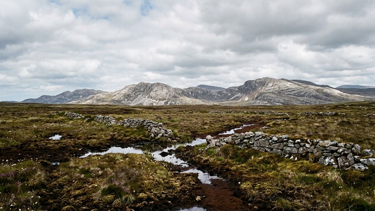
Half the people who write to us about this coast have a photograph in mind: an empty road, a mountain going straight into water, nobody else in the frame. That photograph exists here. It was probably taken in the Inagh valley in the twenty minutes after a shower, and the parking lot behind the camera had eleven cars in it. If you want to book a week in Connemara, the first fact to hold is the one about company: this is the nearest wild-looking coast to a major airport in the whole of the Irish west, and the region carries the traffic that goes with that.
The second fact is water. Not the sea, though there is a great deal of that folded into inlets, but the ground. Blanket bog covers most of the low land, several feet deep in places, holding rain the way a sponge does and releasing it into rivers the color of strong tea. Between the bogs stand the quartzite hills, pale gray, steep-sided, and bare. They are not high. Benbaun, the tallest, is 2,395 feet. What they do instead of height is rise from near sea level in a single unbroken effort, so a hill that reads as modest on paper costs a real morning.
The third is that everything is close together. The whole area you will be driving fits into roughly 45 miles by 45 miles. That is the argument for one base rather than three, and it is why this week is built the way it is: you unpack once, and the furthest thing you will want to see is about an hour away.
- What the week is
- One house or small hotel for all seven nights, a hire car collected at the airport, and days built around walking, driving the inlets, and sitting out weather.
- What sets it apart
- Shannon or Galway puts you at your base in about 90 minutes, against roughly 3 hours 30 minutes of driving from the nearest comparable airport to the Donegal coast; the walking is short and steep, with Diamond Hill at 1,463 feet and Benbaun at 2,395 feet reached from parking lots less than 5 miles away; the whole region fits inside a 45 mile square, so no day needs more than about an hour of driving each way; from $2,180 per person for seven nights, which is roughly a fifth above what the same seven nights in the far northwest cost us to assemble this season.
- What the figure covers
- Seven nights in one property, room only or self-catering depending on the base chosen; a compact hire car from arrival to departure with unlimited mileage; ferry crossing to the islands off the coast for one day; a written day-by-day sheet with parking lots, gates, distances and turnaround points; a local walking guide for two of the seven days; airport meet at the rental desk.
- What it leaves to you
- Flights to Ireland and any baggage; all meals, including breakfast at bases where it is not part of the room; fuel, tolls and parking lot fees; the rental company's own excess reduction product, which you arrange with them directly at the desk; entry to houses, gardens and the national park visitor building; the guide on the remaining five days; anything on the islands beyond the crossing itself; drinks; laundry.
- Who this one is wrong for
- Anyone who wants to leave the raincoat at home. Rain falls on roughly 225 days a year here and a week without it is unusual rather than expected. The hills are quartzite scree and wet blanket bog with no engineered path above the first quarter mile, so the ascent is done on loose, uneven, often soaking ground. Roads to the western inlets are single track with grass down the middle and passing places, and if you would rather not reverse a hire car 200 yards to let a tractor through, take a base on the main road and say so when you write. December through February the light is gone by 4:30pm and several of the small bases close.
What the ground does underfoot
Above about the first quarter mile of any hill here, the made path stops. What follows is either quartzite scree, which is loose, angular, and rolls, or wet bog, which is spongy, hides holes between tussocks, and takes a boot to the ankle without warning. Neither is difficult in the technical sense. Both are slow. A walk described as four miles will take you longer than four miles takes you at home, and the descent will take nearly as long as the climb because the scree does not permit hurrying.
Diamond Hill, at 1,463 feet, is the exception and the reason it is always busy: it has a built path and a boardwalk most of the way, and the round trip runs about three hours at a steady pace. It is where most people spend their first walking day. Benbaun and the ridges behind it have nothing of the sort. You leave the road, cross bog for perhaps a mile, and then climb 1,800 feet of loose stone with no marked line to follow, and you come down the way you went up.
The coast is a separate proposition. West of the main road the land breaks into hundreds of inlets, and the roads that serve them are single track with passing places and grass growing in the center. Driving times on a map mean nothing here. Twelve miles of that road is forty minutes, longer if you meet a trailer. The compensation is that you can park at the end of most of them and walk out onto white shell sand with nobody on it, in July, at two in the afternoon.
People who wrote to us wanting somewhere else
Nobody arrives with a blank mind. Almost everybody arrives with a picture, and often the picture belongs to a different part of the coast. That is not a problem to be argued with, it is a thing to be checked before money moves.
Which months do what here
Weather here is not seasonal in the way most people expect. It is maritime, which means the year is compressed: winters that rarely freeze, summers that rarely get hot, and wind as the variable that actually changes. What moves across the year is light and daylight length, not temperature.
- May and June
- Driest stretch of the year, average highs in the low 60s F, light until after 10pm, and the bases fill first for these weeks
- July and August
- Warmest, average highs about 66 F, and the busiest by a wide margin; single track roads carry campervans and the popular parking lots are full by 10am
- September and October
- Wind picks up and rain totals climb, but the light is long and low and the roads clear out after the first week of September
- November through February
- Dark by 4:30pm, average highs around 46 F, frequent gales off the Atlantic, and several small bases close for the season
- March and April
- Cold, bright, and unsettled; hill days are possible but the boat to the islands is canceled more often than it runs
Between your message and a figure
- 1. You write
- Tell us which coast you think you want, how many walking days you have in you, and whether single track roads are acceptable. A message is opened before the working day ends.
- 2. We check the ground
- We put the two regions side by side in facts: driving hours, ascent, season, cost. We do not tell you which to take. That part is yours.
- 3. We assemble
- We hold a base, price the car and the crossing, and write the day sheet with actual parking lots and turnaround points on it. This takes two to four working days.
- 4. You get a written figure
- Everything itemized, what is in it and what is not, with the note that final costs are confirmed at the time of booking. No payment is taken on this site.
The question people put off asking
The useful questions are the ones people feel silly asking. How wet is wet. Whether a compact car really fits those roads. Whether the week works with one non-walker in the party. Whether the other coast is the better fit for what you actually described, which we will answer in facts and leave with you. Write, and say what you are picturing.